Using Port Phillip maps
Our maps
Port Phillip maps can help you travel around Port Phillip, find services and facilities near you, and discover property information. Maps include:
How to use our maps
Need help? Take a look over the tips and tricks listed below.
Searching
There are 3 ways to search:
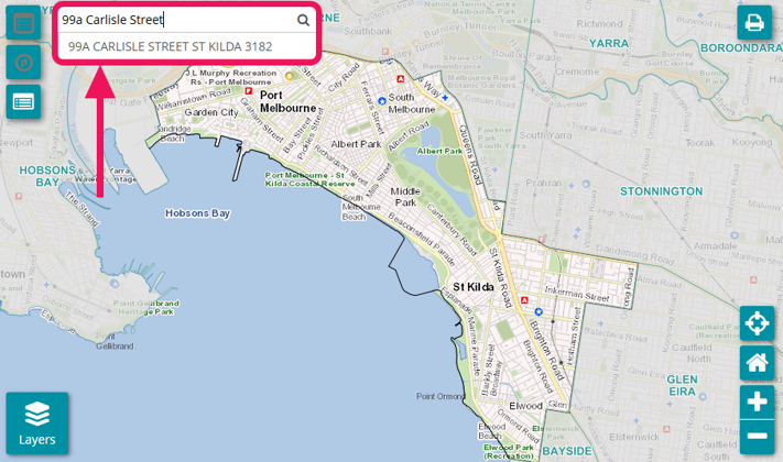
1. Search bar
To search for your nearest facilities or services, enter your address in the search box. You can type the address in full or choose the corresponding address from the drop-down list.
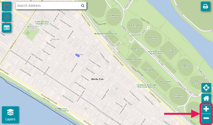
2. Zoom
If you do not know your address, you can lick and drag to move the map around and use the + button to zoom in and the - button to zoom out. Select your address on the map when you find it to display its details.
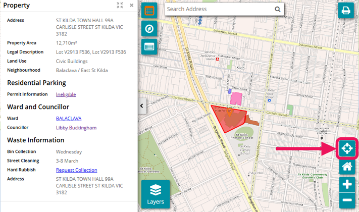
3. GPS locator
If you are at the location where your address is, select the crosshairs button to go to your GPS location.
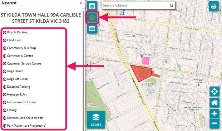
Nearest categories
To find the nearest category, select the compass button. Expand the category that you are interested in to find the closest facility or venue to the address you have selected.
Depending on which map is used, the category you select will be highlighted on the map. In this example, the NearMe map is used to show the nearest facility or service to the address provided.
Browsing
Browse by using your mouse, touch screen or keyboard
Aerial view
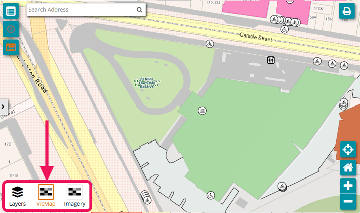
Use the layers button to select between State Government Authorised data (VicMap) or aerial imagery.
Map legend
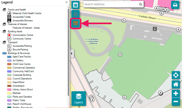
To find out more information about the symbols on the map, select the legend button on the left of the map.
Printing
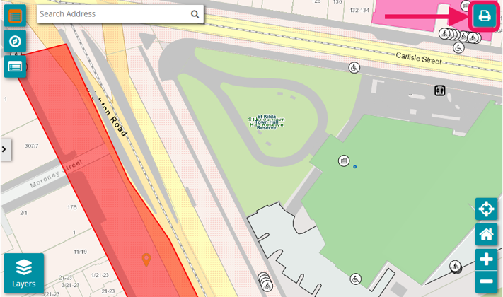
To print a copy of the map as a PDF, select the print button in the top right corner of the map. This option will open a new window that will enable you to preview print and save as a PDF.
Feedback
A feedback link is available below the map for users to provide comments regarding site content, usability and accessibility.
Land size or construction date information
LANDATA® holds and manages information on:
- the area (size) of a parcel of land or building
- construction date of a building.
LANDATA® operates on behalf of the Victorian Land Registry Services.
Enter your property’s details and then request a Valuation Report.
Map disclaimer
Maps contain information relating to properties, features and assets located within the City of Port Phillip sourced from internal and external agencies.
Care has been taken to ensure that data is accurate and current. However, some variations from records do exist, and complete accuracy cannot be guaranteed and data may not be appropriate fit for your particular purpose.
The City of Port Phillip employees disclaim all liability for any error, loss or consequences which may arise from you relying on any information contained in this material.